 USD $
USD $ EUR €
EUR € HKD HK$


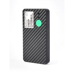
What are the functions of 4g gps tracker?
I often hear people say that GPS is very good. You can install it in your mobile phone or on the car. You won't get lost wherever you go. It feels very mysterious. Is GPS really so magical?
Yes, I don’t know if you have used Baidu Maps this map software, it is derived from the GPS database. The following is a list of some of the wide-ranging applications of GPS in our real life, I hope it can be helpful to your problem. Thank you! GPS satellite positioning system is mainly for positioning and navigation of moving objects such as ships, cars, and airplanes.
1. Vehicle tracking: Using 4g gps tracker and electronic map, the actual position of the vehicle can be displayed in real time, and it can be zoomed in, zoomed out, restored, and changed at will; it can move with the target so that the target is always on the screen; it can also achieve more Simultaneous tracking of windows, multiple vehicles, and multiple screens. Use this function to track important vehicles and goods.
2. Provide travel route planning and navigation: Providing travel route planning is an important auxiliary function of the car navigation system, which includes automatic route planning and manual route design. Automatic route planning is determined by the driver to determine the starting point and destination, and the computer The software automatically designs the best driving route according to the requirements, including the fastest route, the simplest route, and the calculation of the route with the least number of passes through the highway section. The manual route design is that the driver designs the starting point, ending point and route according to his own destination Point, etc., automatically establish a route library. After the route planning is completed, the display can display the designed route on the electronic map, and at the same time display the car's running path and running method.
3. Information query: Provide users with databases of main objects, such as tourist attractions, hotels, hospitals, etc., and users can display their location on an electronic map. At the same time, the monitoring center can use the monitoring console to check the location of any target in the area. Inquiry, the vehicle information will be displayed in digital form on the electronic map of the control center.
4. Traffic command: The command center can monitor the operating conditions of vehicles in the area, and conduct reasonable dispatch of the monitored vehicles. The command center can also talk to the tracked target at any time for management.
5. Emergency assistance: The GPS positioning and monitoring management system can provide emergency assistance to vehicles in danger or accidents. The electronic map of the monitoring station displays help information and alarm targets, plans the optimal assistance plan, and alerts with sound and light alarms Personnel on duty perform emergency treatment. In addition to other applications of GPS, GPS is used for navigation, positioning, and measurement. Since the accurate clock on the space satellite of the GPS system can release time and frequency information, it is based on the accurate clock on the space satellite. , Under the monitoring of ground monitoring stations, the transmission of accurate time and frequency is another important application of GPS. The application of this function can be used to control accurate time or frequency, which can serve many engineering experiments. In addition, GPS can also be used to obtain meteorological data , For some experimental and engineering applications.
Related Recommendations
Guide to buying 4g lte gps tracker, that brand’s 4g lte gps tracker is good
4g long standby asset tracker & equipment
What does "LBS" in 4g car gps tracker mean?
- Contact EELINK
 Globalsales@eelink.com.cn
 tan3051_1
 +86 18218746415
- NEWSLETTER
- Getting the latest GPS devices news From Eelink.
- SUBSCRIBE